Build a static site from IIIF resources

Connect to cultural heritage material at any institution and generate a fully searchable, filterable, and browsable digital site highlighting items from IIIF collections and manifests.

canopy.yml
title: Art & Empirecollection:  - https://api.dc.library.northwestern.edu/api/v2/collections/7ac5769f-a1d9-4227-a350-bf8bd8b1cddc?as=iiif  - https://api.dc.library.northwestern.edu/api/v2/collections/94536627-cfdf-413c-852b-0cb16d986da3?as=iiifmanifest:  - https://iiif.vam.ac.uk/collections/O1267239/manifest.json  - https://iiif.vam.ac.uk/collections/O755793/manifest.json  - https://iiif.vam.ac.uk/collections/O136839/manifest.json  - https://iiif.vam.ac.uk/collections/O74660/manifest.jsonmetadata:  - Subject  - Date  - Language  - Genrefeatured:  - https://api.dc.library.northwestern.edu/api/v2/works/4bdb5a22-6c7f-498d-8e6e-e49ea9bc4778?as=iiif  - https://api.dc.library.northwestern.edu/api/v2/works/c26591b2-994b-4ba3-a87e-9124419fa91b?as=iiiftheme:  appearance: light  accentColor: gold  grayColor: gray
Miniatures on mica, [seated woman at desk, writing]
Miniatures on mica, [seated man making lanterns]
Miniatures on mica, [crouching man with pipe]
The Amir Sher Ali, Prince Abdallah Yan, and Durani chiefs
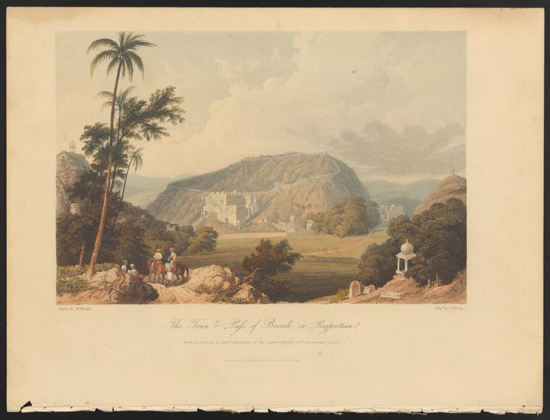
The town & pass of Boondi, in Rajpootana
Veuve indienne enterrée vivante auprès de son époux.
Miniatures on mica, [seated woman sewing]
Miniatures on mica, [crouching man with firearms]
East India prints
East India prints
Scene at Colgong on the Ganges
Gouvernemens généraux du Lyonnois et de L'Auvergne
A Baluch mendicant
A Baluch mendicant
Miniatures on mica, [standing man holding fish]
Miniatures on mica, [standing man, profile]
Calcutta, the Esplanade
The British Residency at Hyderabad
Le roy de Cochin sur son éléphant accompagné de ses Nayres.
Dus Awtar, caves of Ellora
Miniatures on mica, [standing man with musical instrument]
Miniatures on mica, [seated man with baskets]
General view of Kalat.
Bénarès
Bénarès
Gouvernemens généraux de Bourgogne, et, de Franche-comte
An accurate map of the East Indies : from the latest improvements and regulated by astronomical observations.
Miniatures on mica, [kneeling man with bell]
Miniatures on mica,  [seated man, metalworking]
Miniatures on mica, [seated man, metalworking]
An elephant fight.
An elephant fight.
Diverses pagodes et penitences de faquirs
Pilgrims at the sacred fair of Hurdwar
Interior of the Great Cave Temple of Elephanta near Bombay

Easily author rich scholarly content

Write your narratives as markdown, add rich components in the same document, and quickly publish your ideas with interactive image viewers, maps, and timelines.

content/corporate-empire.mdx
### Corporate Empire and Cartographic Authority By the early nineteenth century, the East India Company had transformed from  a trading enterprise into a territorial power, exercising corporate sovereignty across much of the Indian subcontinent. Maps such as this one helped naturalize that expansion by translating diverse political landscapes into legible borders, routes, and regions that could be governed, taxed, and defended. The atlas format reinforced these claims by presenting Company influence as stable geography rather than contested rule. <Image  src="https://iiif.dc.library.northwestern.edu/iiif/3/f0e6bb1d-f5a4-4b20-ad08-1ee9db915c9f"  height="400px"  isTiledImage  alt="Map of Hindostan (1811)"  caption="“Hindostan” from Pinkerton’s Modern Atlas shows the Indian subcontinent through a British colonial lens. Its borders, place names, and measurements reflect imperial rule and East India Company influence."/> This cartographic vision also reveals how knowledge production and imperial power worked together. By privileging standardized measurement, European place-name conventions, and administrative divisions, the map frames the subcontinent as a coherent space open to managerial control. Such representations supported both practical governance and public legitimacy, offering metropolitan readers an image of order and possession that obscured local authority, resistance, and the uneven realities of Company rule.

Corporate Empire and Cartographic Authority

By the early nineteenth century, the East India Company had transformed from a trading enterprise into a territorial power, exercising corporate sovereignty across much of the Indian subcontinent. Maps such as this one helped naturalize that expansion by translating diverse political landscapes into legible borders, routes, and regions that could be governed, taxed, and defended. The atlas format reinforced these claims by presenting Company influence as stable geography rather than contested rule.

“Hindostan” from Pinkerton’s Modern Atlas shows the Indian subcontinent through a British colonial lens. Its borders, place names, and measurements reflect imperial rule and East India Company influence.

This cartographic vision also reveals how knowledge production and imperial power worked together. By privileging standardized measurement, European place-name conventions, and administrative divisions, the map frames the subcontinent as a coherent space open to managerial control. Such representations supported both practical governance and public legitimacy, offering metropolitan readers an image of order and possession that obscured local authority, resistance, and the uneven realities of Company rule.

What is Canopy?

Canopy helps researchers, libraries, archives, and museums create polished digital projects with intuitive tools that showcase IIIF resources. It lets scholars and digital humanists curate works from many sources and add context and narrative. Built on IIIF’s decentralized and interoperable APIs, Canopy provides a customizable modern front end that needs no backend or database, allowing quick setup and low maintenance. In minutes, users can generate fast, lightweight static sites that are easy to host and draw on IIIF’s rich metadata and media.

  • Builds a static web site directly from IIIF collections and manifests.
  • Generates a work page representing each IIIF manifest.
  • Indexes Manifest metadata automatically for search and filtering
  • Provides clear, reusable IIIF-based components for presentation.
  • Supports Markdown authoring for contextual and scholarly writing.
  • Runs entirely without an integrated database or backend.
  • Produces fast, lightweight, low-maintenance sites that are easy to host.
Have an idea for a project?

Highlighted items

This section features an organized selection of IIIF manifests referenced in this project. Each slider displays items matching the most common results for metadata labels such as Genre, Language, and Subject, linking resources across the project.